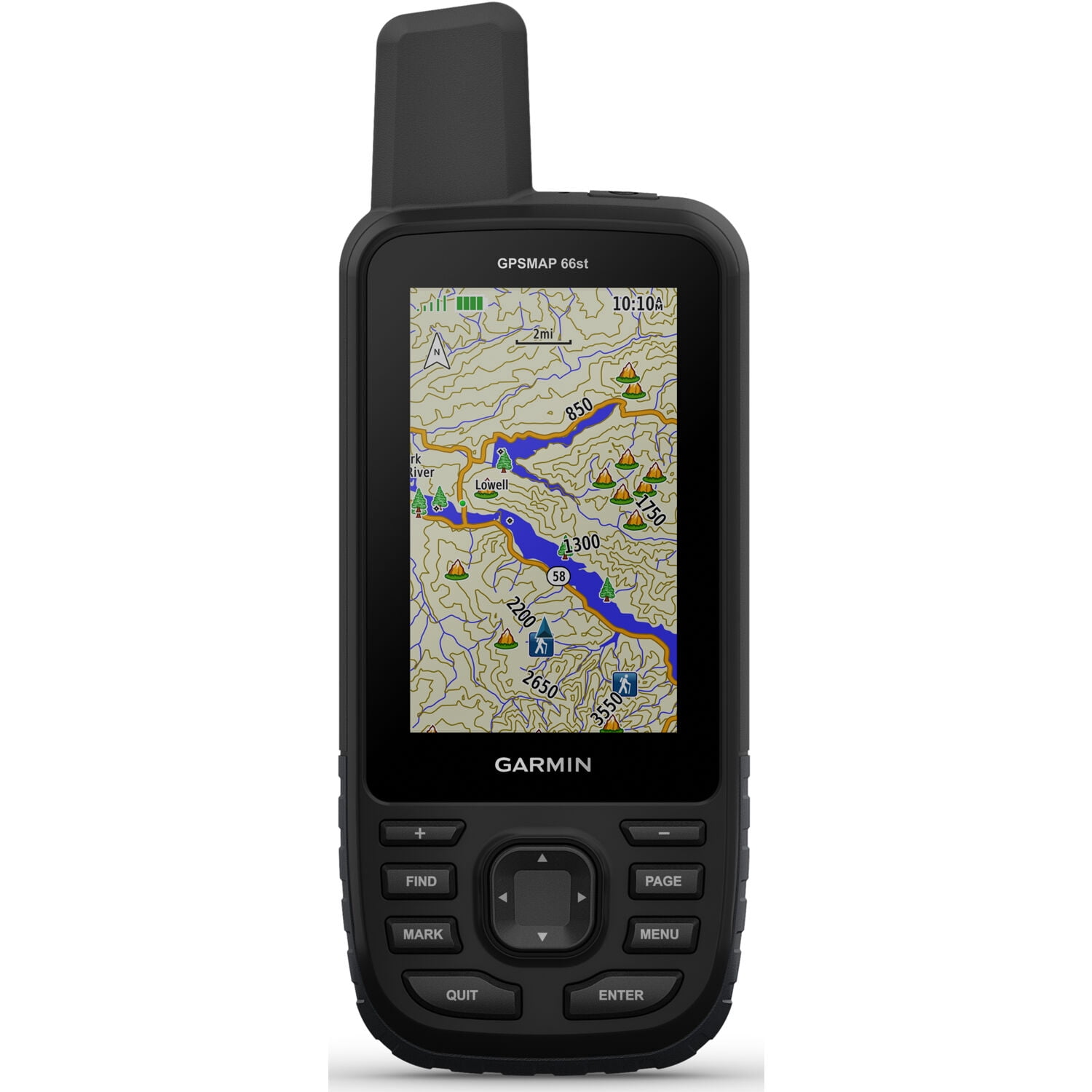
Garmin Garmin Handheld Hiking GPS with Sensors and TOPO Maps
Product details
| Management number | 254806913 | Release Date | 2026/11/07 | List Price | US$162.54 | Model Number | 254806913 | ||
|---|---|---|---|---|---|---|---|---|---|
| Category | |||||||||
Discover and navigate your next outdoor adventure, and see your surroundings clearly with GPSMAP66st. This premium, rugged handheld has a 3” color display and access to BirdsEye Satellite Imagery with direct-to-device downloads through Wi-Fi wireless networking and preloaded TOPO U.S. and Canada maps. It provides multiple Global Navigation Satellite Systems (GNSS) support to track your route in more challenging environments than GPS alone plus ABC (altimeter, barometer and compass) sensors. Wireless connectivity through ANT+ technologies provides Active Weather updates and compatibility with the Garmin Explore app for offline access to cloud-based route planning.
Garmin Handheld Hiking GPS with Sensors and TOPO Maps
- Large 3” sunlight-readable color display for easy viewing
- Multiple Global Navigation Satellite Systems (GNSS) support to track your travels in more challenging environments than GPS alone plus three-axis compass and barometric altimeter
- Access to BirdsEye Satellite Imagery with direct downloads and no annual subscription plus preloaded TOPO U.S. and Canada maps
- Expanded wireless connectivity supports Active Weather for up-to-date forecasts and animated weather radar and Geocaching Live for mobile syncing and updates
- Compatible with the Garmin Explore website and app to help you manage tracks, routes and waypoints and review statistics from the field
- Up to 16 hours of battery life in GPS mode; 1 week in Expedition mode (with 2 AA batteries)
- Screen Dimensions: 1.5"W x 2.5"H
- Memory: 16 GB (user space varies based on included mapping
| Brand | GARMIN |
|---|---|
| Model name | 66st |
| Rec. use | Hiking, Motorcycle |
| Screen size | 3 in |
| Resolution | 240 x 400 |
| Battery life | 16 hr |
| Power type | Battery |
| Accessories | Access to Birdseye Satellite Imagery, USB Cable, Carabiner Clip, Documentation, Compass, Barometer, Altimeter |
| Touchscreen | N |
| Mount type | Handheld |
| Map type | TOPO |
| Data storage | 16 GB |
| Features | Color Screen, Barometric Altimeter |
| Battery consumption type | Changeable Disposable Battery |
| Color | Black |
| Sport | Bicycling, Hiking |
| Weight | 0.9 oz |
| Dimensions | 10.00 x 8.00 x 6.00 Inches |
| Vehicle type | Motorcycle |
| Input/output type | Wireless |
| Inputs & outputs | Inputs - USB, Memory Card Slot |
| Battery size | AA |
| Series | 66 |
Bestseller ranking
L.O.L. Surprise! Dolls

Correction of product information
If you notice any omissions or errors in the product information on this page, please use the correction request form below.
Correction Request Form